Connecting the Grand Paris – France
The region of Île-de-France and the metropolitan area of Paris
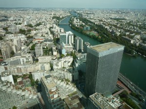
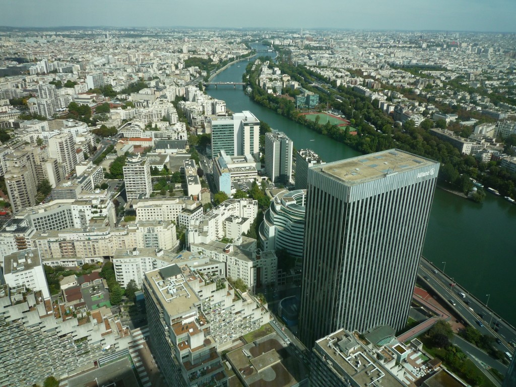
Île-de-France occupies a total area of 12.011 km² and is the wealthiest and most populated administrative region of France. Economically, Île-de-France is the worlds fourth-largest and Europe’s wealthiest and largest regional economy: in 2009, its total GDP was €552 billion (Eurostat), about 30% of the GDP of France. Ninety percent of its territory is covered by the Paris metropolitan area which extends beyond its borders in places.
In the last 100 years the population in the metropolitan area grow from about 4,5 millions to 12,1 million inhabitants in 2009, while in the same period the population of the town of Paris decreased from about 2,8 millions to 2,2 million inhabitants in 2009. The growth of the population during this period took place in the metropolitan area and to the disadvantage to its main municipality.
But the demographic dynamics evolved differently during the decades. Between 1975 and 1990 there was larger increase of population and jobs in the outskirts based, amongst others factors, on the development of five new towns in a distance of 20 to 30km around Paris and the construction of the rapid transit system (RER). During the following period form 1990 until 2007 the main increase in population and jobs shifted closer to the centre, to the suburbs situated in the inner circle just outside of the town of Paris.
Radial public transport network and congestion in the centre
The Parisian metro system had been developed since 1900 and counts today 214 km with 301 stations. It is manly a radial system with lines coming from their terminus in the first ring of suburbs and crossing in the centre of Paris. Unadapted to cover the larger metropolitan area, the rapid transit system (RER) had been developed from 1960 and counts today 587 km with 246 stations. Its layout is likewise a radial system, with intersections at the main Parisian metro stations.
This layout provides a good public transport network inside of Paris and good connections between Paris and the suburbs, but an insufficient offer for movements between suburbs. The user mostly has to pass by the main Parisian stations, even to go from suburb to suburb leading to an unnecessary congestion of the main transport intersections in the centre, like “Châtelet-Les-Halles, St Lazare, Gare du Nord”. In consequence the suburban population prefers the use of cars and today it is used in 80% of all movements between suburbs. Taking into account that the movements between the suburbs increased by 50% from 1976 to 2001, it will lead to growing car traffic congestion.
From Orbitale to Métrophérique
The first project of a concentric ring metro line outside of the town of Paris had been proposed in 1991 by the Institut d’aménagement et d’urbanisme de la région d’Île-de-France (IAURIF). 2006 followed the project of the Métrophérique presented by the Régie autonome des transports parisiens (RATP) and in the same year the government of Île-de-France presented the project Arc-Express. All three projects had similar characteristics.
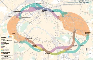
Arc-Express was a project of a concentric metro line composed out of four arcs, linking the RER station of the suburbs just outside of the town of Paris. Given the density these urban areas to be crossed by the Arc Express, most of the track had to be underground. For a total length of about 60 kilometres, the project was estimated at 6 billion euro (based on cost of about 100 million euro per kilometre), plus the cost of stations, additional facilities, and land acquisition. At this tile the project could cost a total of 8 to 10 billion euro and the first sections of the Arc Express could open in 2017.
Le Grand Pari(s) – Ville-Monde ?
In May 2007 Nicolas Sarkozy had been elected president of France and he was determined to push forward the economic development of Île-de-France. In September 2007 he announced an international consultation about the future of the metropolis of Paris and 10 international teams work between 2008 and 2009 on a strategy Post-Kyoto for the region.
The reason for this personal implication was the assumption that the development project of the regional government was not ambitious enough. Between 2000 and 2008 the average economic growth of Île-de-France was 2% while in the metropolis of New-York and London is was situated between 3% and 4%. Taking into account the major economic role of the region in France and on an international level, a stronger economic growth of the region would have an impact on the whole of France.
Metro Grand Paris / Grand Paris express
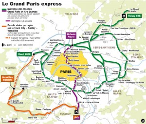
After presenting the results of international consultation Le Grand Pari(s), Nicolas Sarkozy unveiled in April 2009 his vision of a new public transport network, the Metro Grand Paris (renamed after some modifications of the initial project in Grand Paris Express).
An automatic metro system with 150 km of new lines and nearly 60 stations. Trains should run with an average speed of 65 km/h and up to 1000 passengers per train. A frequency of down to 85 seconds between two trains at the rush hour assures a high capacity.
The main objectives were: Connecting the suburbs and reducing the car traffic; connecting the economic and scientific clusters; building major urban transport intersections and structuring the metropolitan area.
While the Arc Express project of the regional government tries to improve manly the public transport in the dense suburbs close to Paris, the Grand Paris Express is seen as an infrastructure project changing strongly the urban structure of the metropolitan area. A general increase of the attractiveness of the region should be reached by this public transport system that is connecting the mayor clusters and encouraging exchange, innovation and knowledge and finally leading to growth of the population, economy, jobs and quality of live. At this time the scenario of the French government aimed an economic growth of 3,5% to 4% for the region of Ile-de-France.
The theory of clusters as a geographical based, innovative network of different economic and scientific actors is based on the work of researchers like Michael Porter, Harvard (On competition, 1999).
The stations
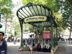
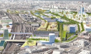
While the Paris Metro system as become a symbol for the city, noted for its density within the city limits, its uniform architecture influenced by Art Nouveau and its unimposing metro entrances, hidden in the urban landscape, the Grand Paris Express system follows another concept. The stations are not only public transport intersections, but highly visible landmarks and urban centres. They offer divers transport systems (Buses, bicycles, car sharing, trains…) and different urban functions (service, consumption, work, entertainment…).They represent a main starting point for the renovation and densification of existing urban areas and for the development of new, sustainable urban areas and economic and scientific clusters.
Feasibility and changes to the project
Different incertitude remains today on the feasibility and the reasoning of this ambitious project. Estimated in 2010 at a cost of 21 to 23 Billion Euros for the construction the question about financing the project is still unsolved. The recent successions of economic crises and the decision to reduce the increase of the national debt of France added to the incertitude of financing the project.
The basic assumptions of the national government for the future development of the region might be overestimated. The aim of an annual economic growth of 3,5% to 4% of the GDP for the region of Ile-de-France seem today in a distant future, as the economic growth in France for 2012 was 0,0% of the GDP.
Questions remain on the strategy to take the theory of clusters as the right choice for the development of the region? There might be other ways and strategy more adapted to the specific characteristics of the territory.
In the presidential election in May 2012 François Hollande from the Socialist Party became the new president of France, replacing Nicolas Sarkozy. This new political situation could be more favourable to reach agreements about Île-de-France on the different administrative levels, as besides the national government (François Hollande), also the regional government (Ile-de-France, Jean-Paul Huchon) and the municipal government (Town of Paris, Bertrand Delanoë) are now conducted by representatives of the Socialist Party. But what changes will the new president apply to the development strategy and the project?
On the 6th March 2013 the French Prime Minister Jean-Marc Ayrault announced that the government of Francois Hollande wills pursuit the planning and construction of the Grand Paris Express. The new network of 200 kilometres and 72 new stations will be completed in 2030 for an estimate cost of now 30 Billion Euros. As stated above, in 2010 the estimation had been 21 to 23 Billion Euros for the same network. 8 Billions Eurs more in three years.
More or less mobility?
In average the population of Île-de-France travels 64 minutes per day for their way to work. And in general, all means of transport included, for 60% of the population the way between work and home is seen as an uncomfortable moment with a negative impact on their live quality.
So is it the right way to react to a growing need of mobility through investing in large scale infrastructures. Is the region of Ile-de-France repeating the important investments in road infrastructures, which had been done to give space to the growing numbers of cars in the 20th century, now for the growing number of passengers of public transport? Is increasing the facility of transport not simply leading to a further development of the urban sprawl and a new demand for new infrastructures in a few years?
The demand for mobility is the expression of the population for the demand of access to jobs, housing, services, facilities… Should the focus not be set on the mixture of function in urban areas, plots and buildings itself, to reduce the distance between home, work, services, etc. Thinking and planning at the local scale and the neighbourhoods in which the population organises its everyday live, might be equally or even more important and sustainable for the development of a “Post-Kyoto Metropolis » that important investments in large scale infrastructures.
Secondary urban infrastructures – Tramways and waterways
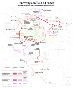
While waiting for the feasibility and development of this major project by the Société du Grand Paris, secondary urban infrastructures, like tramways structure the territories with success and acceptance by the populations. Parallel to the existing transport infrastructures, a network of tramways is constructed in the region. Offering a transport capacity between the bus and the metro, the tramway as become an essential backbone for the transformation of urban areas.
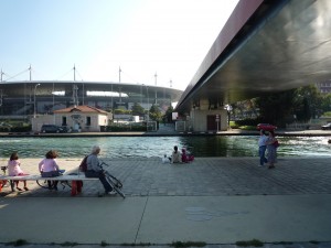
The existing waterways and channel in the North-east of Paris form another secondary infrastructure for the development of industrial or degraded quarters. Accompanied by walkways and bicycle lanes they become a symbol of quality for living and working and a summer meeting point for leisure.
Author: Christian Horn is the head of the architecture and urban planning office rethink
